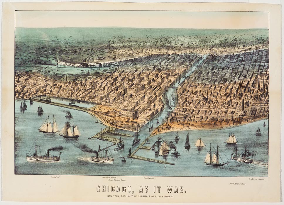
Aerial view of city along river. Sailboats and steamboats out on river and in and out of canal. Landmarks labeled under print. Left to right: “Lake Park”; “Mouth of River”; “Court House”; “Dr Colyer’s Church”; “South Branch River”; “North Branch River”.
This map of Chicago was printed by Currier & Ives to document the city’s landscape prior to the two historic fires that took place in 1871 and 1893. Lake Michigan appears in the foreground, with the entrance to a canal that runs through the heart of the city. Many ships, both sail and steam, navigated the waters of the lake.