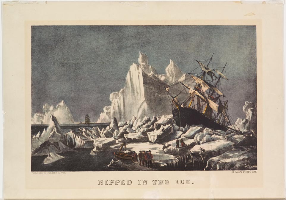
Glacier scene ship stranded up on iceberg to right. Men at forefront with small boat. Masted ship in left background.
The Clipper Route was the traditional route sailed by clipper ships between Europe and the Far East, Australia and New Zealand. The route ran from west to east through the Southern or Antarctic Ocean, in order to make use of the strong westerly winds of the Roaring Forties (latitudes between 40s and 50s). Many ships and sailors were lost in the difficult conditions along the route, particularly at Cape Horn, which the clippers had to round on their return to Europe. The Clipper Route became less popular with the introduction of steam ships and the opening of the Suez and Panama Canals. However, it remains the fastest sailing route around the world. Part of the route was inside the ice zone, the area of the Antarctic Ocean where there were significant icebergs. Safety dictated ships keep to the north edge of this zone, but the great circle route (from the Cape of Good Hope to Australia) was 1,000 miles shorter and offered the strongest winds. Ships’ captains would go as far south as they dared, weighing the risk of ice against swift passage. Currier & Ives recognized public interest in these dangerous voyages and created prints that chronicled the perils of sea voyage as in Nipped in The Ice.