
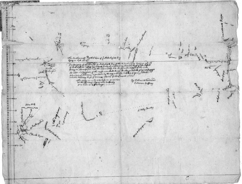
“A Description of the Extent of the Bounds of Massachusetts Bay…, by Nathaniel Woodward and Solomon Saffery, 1642. Inscribed: “A description of the extent of the bounds of Massachusetts Bay Patent, Southward, lying in 41 deg. 55 minutes North Lattitude Crossing Connecticutt River at Winsor ferry place, the house of John Bissell being on the west side and the widow Gibbs her house on the East side of the river. Also a description of the most remarkable rivers, brooks, ponds, hills, playns, swamps, situation of Indians discovered by the waye with the Lattitude of Springfield, 42 – 6 and the trading house of the Oronocos, the 14th of ye 4th month: 1642”. This is an historically notable map, drawn in 1642, when the Massachusetts colony dispatched two Boston surveyors to map its border with Connecticut. The two surveyors, Nathaniel Woodward and Solomon Saffery, started their work three miles south of the Charles River. From there, according to the Massachusetts charter, the colony’s southern boundary was to run west to the Pacific Ocean. Instead of traveling westward along the state line, Woodward and Saffery chose to sail around Cape Cod, down into Long Island Sound and up the Connecticut River, until they reached what they believed was the proper latitude. In fact, they were about seven miles too far south. So they fudged the mistake and kept moving west. This added 108,000 acres of what had been Connecticut to Massachusetts. Thus began decades of feuding and resulted in the creation of the “Southwick jog” or Notch. The Early Springfield Manuscript Collection contains documents from the western Massachusetts region during the colonial period (with some exceptions). There are personal papers, town records, militia records, and miscellaneous documents dating from the earliest days of Springfield, including Pynchon family material.
“A Description of the Extent of the Bounds of Massachusetts Bay…”, 1642
Related Items
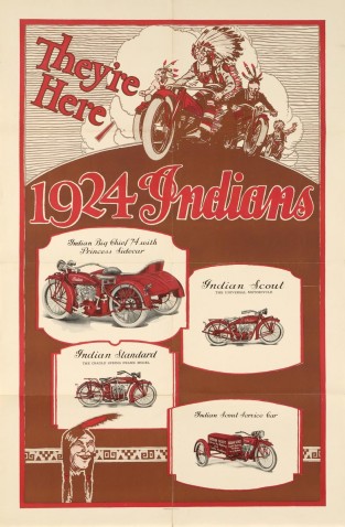
Poster: 1924 Indian Motocycles
Color poster, 25" wide by 38" high, advertising the 1924 line of Indian Motorcycles. Highlighted models are the Indian Big…

Bill of Sale for Jenny, 16 February 1808
Bill of Sale for Jenny, 16 February 1808, with signatures of contributors. (The original document is restricted, however photocopies of…

“The Meritorious Price of Our Redemption”, by William Pynchon, 1650
William Pynchon's "The Meritorious Price of Our Redemption", published in 1650 in London and printed by George Whittington and James…